Lake LaDue on Life Support!

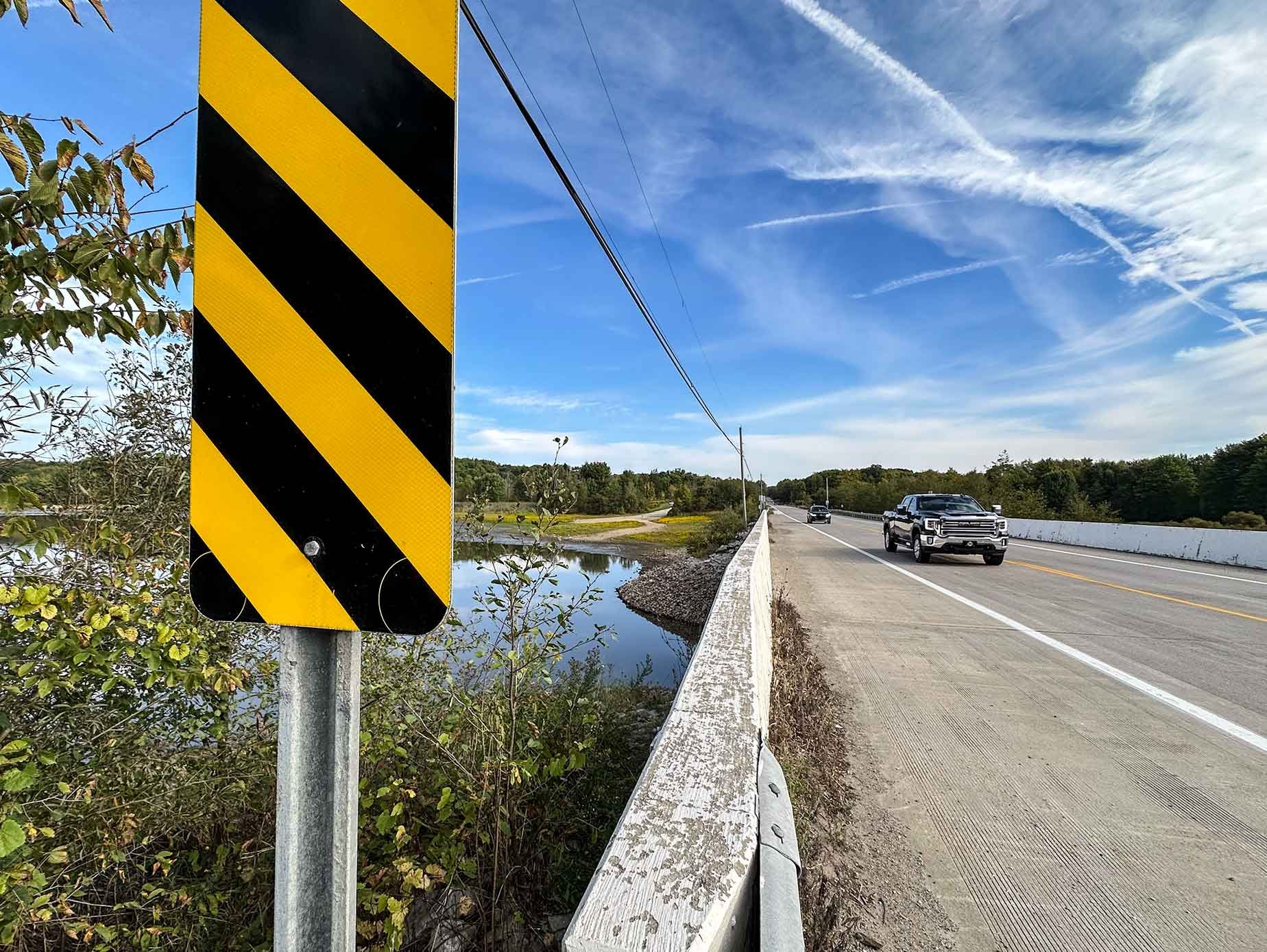
Looking west from the Route 44 causeway. The width of the reservoir has been reduced to a few hundred feet here. In normal times, the water stretched across to the distant tree lines.
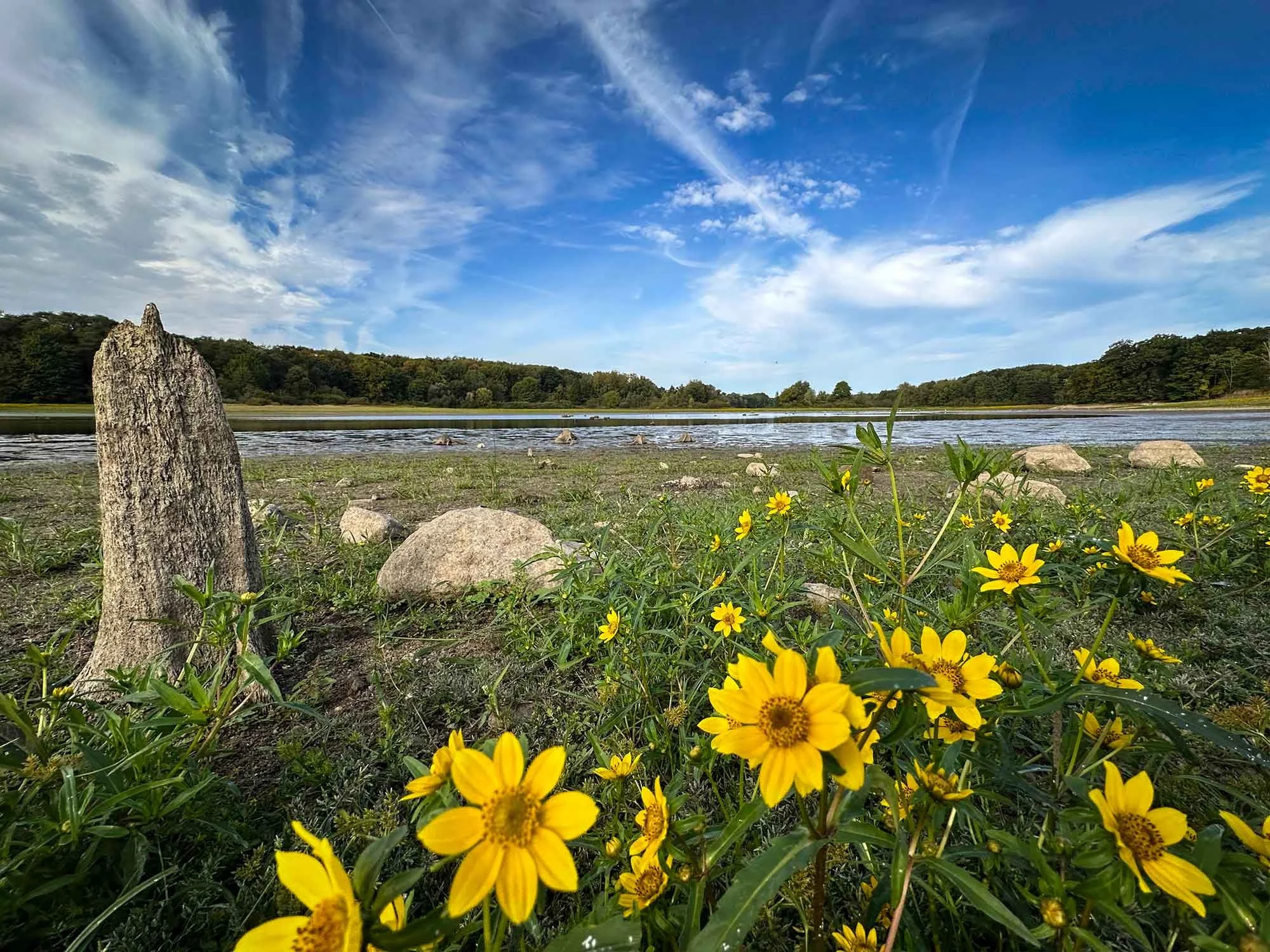
Water levels at the LaDue Reservoir in Auburn Township Ohio have reached critical levels. The abnormally dry conditions of summer have persisted thus far into mid-September. The water level typically decreases at this time of year, but local residents have noted that they have never seen it this low. Areas that were once submerged are now bone dry and covered with vast expanses of brilliant yellow swamp marigolds. Hardest hit is the south end of the reservoir visible on either side of the Route 44 causeway. The old waterline is now many yards away from the remaining water which has pooled in the deeper center section. Walking down the boat ramp I was astounded by how far in I was able to proceed before reaching any trace of water or even moisture in the ground. The aquatic birds that roost in this area are now clustered on a relatively small and shallow pool of water. I saw no sign of fish during my exploration; presumably they migrated to the deeper north end of the lake to wait out the drought.
Despite the apocalyptic look of a drained lake, I was struck by the incredible beauty of the place. A weird dichotomy accentuated by the brilliant flowers and blue sky. There was also an eeriness about walking in areas that were previously accessible only by canoe or kayak.
Don’t know how this water drop affects the City of Akron that relies on part on the lake for its water supply. But it’s fair to say it will take significant rain to even begin to replenish it.
Written and photographed by Dave Dreimiller. Please follow my photography on Facebook: https://www.facebook.com/profile.php?id=61571786786477

This sign has been posted in an area that was once submerged by the lake waters…

Here’s a view looking east from the south end of the Route 44 causeway.

The old shoreline is visible at upper right in this photo, now several feet above the remaining water.


Looking north from the Route 44 causeway.


Ground level view of the Route 44 causeway, for years a favorite fishing spot. A shallow channel of water still flows beneath the bridge, but there were no fish to be seen.


Looking east over the narrow channel of water that flows beneath the Route 44 causeway. The old waterline once extended all the way to the tree lines on both left and right in this view.

An egret takes flight from a rotten stump in the remaining watered section of the lake. I saw many aquatic birds clustered in this area, all competing for an ever-decreasing source of food.

The soft ground near the water’s edge in this photo suggest a fairly rapid and recent drop in water level suggesting the end has not yet been reached.

The sweeping arc of swamp marigolds clearly defines the previous shoreline.

The remains of a rope swing that once hung over the water is now suspended over dry land. The lake has receded so far here that it is no longer even in sight.
